• Services
    • Geotechnical Investigations
    • Landslides
    • Soil Testing
    • Groundwater
    • Wastewater
    • Coasts
    • Contaminated Sites
  • Products
    • Cromer Hydrogeological Calculators
    • Cromer Constant Head Field Permeameter
    • Trench® Wastewater Software
  • About
  • News
    • News Archive
  • Publications
    • Cromer Reports Database
  • Contact me

Bill Cromer

Home » You searched for "rockfall"

Search Results for: rockfall

Mt Wellington rockfall

July 26, 2014 by Bill Cromer Leave a Comment

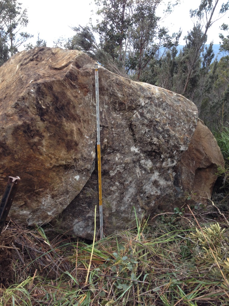
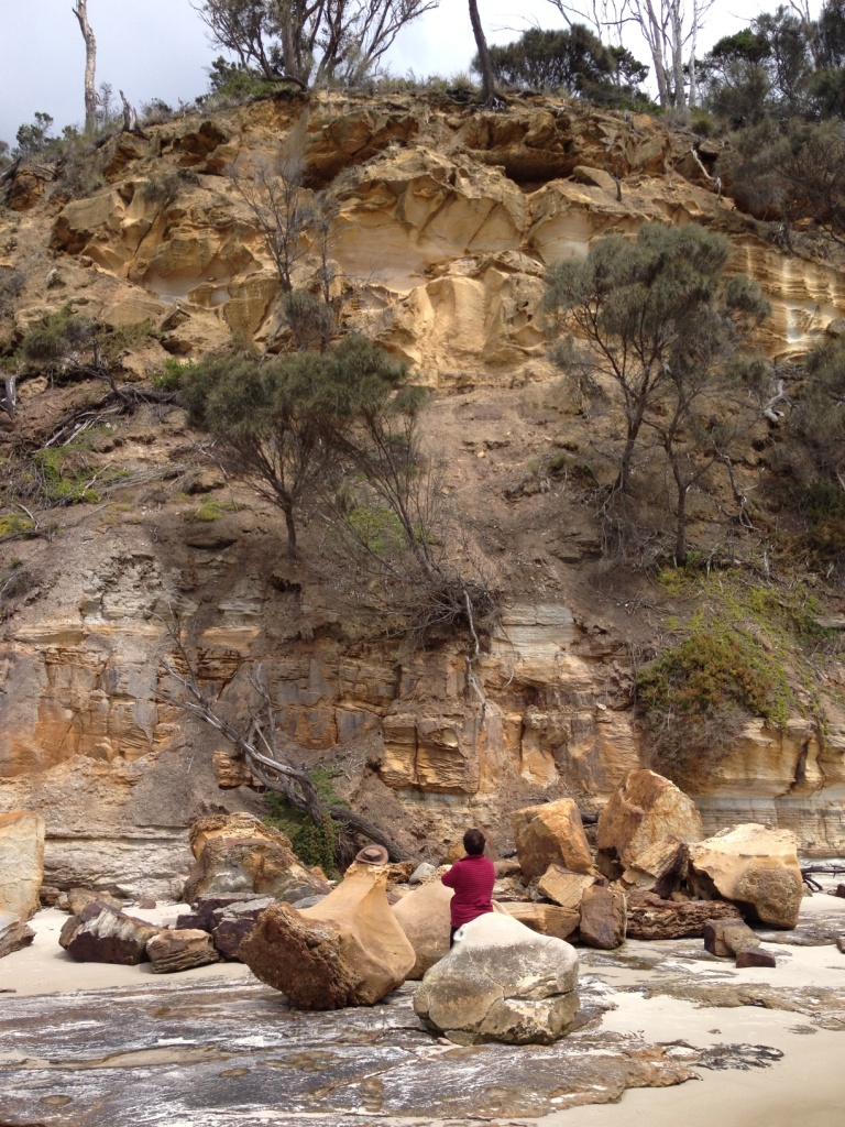
On 8 July, Hobart City Council asked me to assess the risk posed to road users and track walkers from a large dolerite boulder (50t) which had toppled off a small cliff section on steep (40+degree) slopes on Mt Wellington. Despite the millions of already-toppled boulders on the adjacent talus slopes, geological time is immense and rockfalls are rare enough to be noteworthy.  This boulder was also larger than most, and since it did not break up, its travel path was longer than most. It came to rest in a muddy bouldery watercourse 170m downslope, about 20m across the Pinnacle Track.

I arrived at the site a few hours after the fall. With daylight hours fading, and uncertain about the boulder’s stability, I though we ought to close the Pinnacle Road to the summit of the mountain. Council organised this immediately.

Next morning, after a Council crew cleared scrub from around our rock, it was clear that the boulder had come to rest against other smaller ones. I thought the potential for it to remobilise was “unlikely’, and the risk to life to a road user 300m downslope was “tolerable”.  Pinnacle Road was reopened, and we instigated a set of monitoring points around the boulder to further assess its stability.

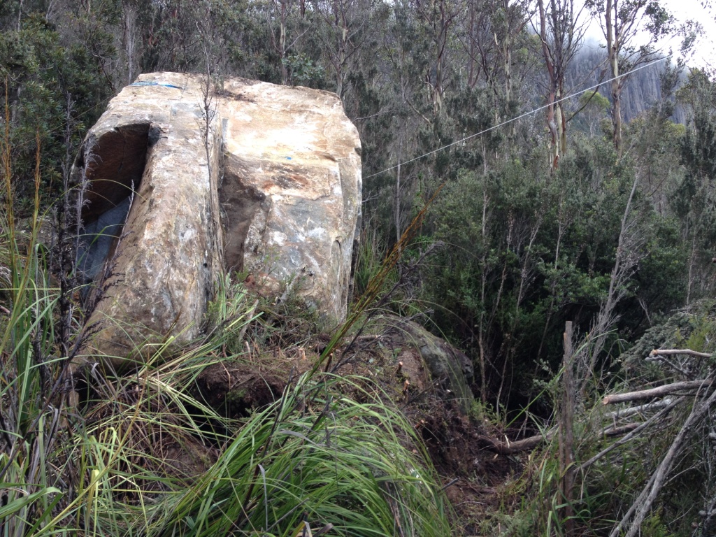
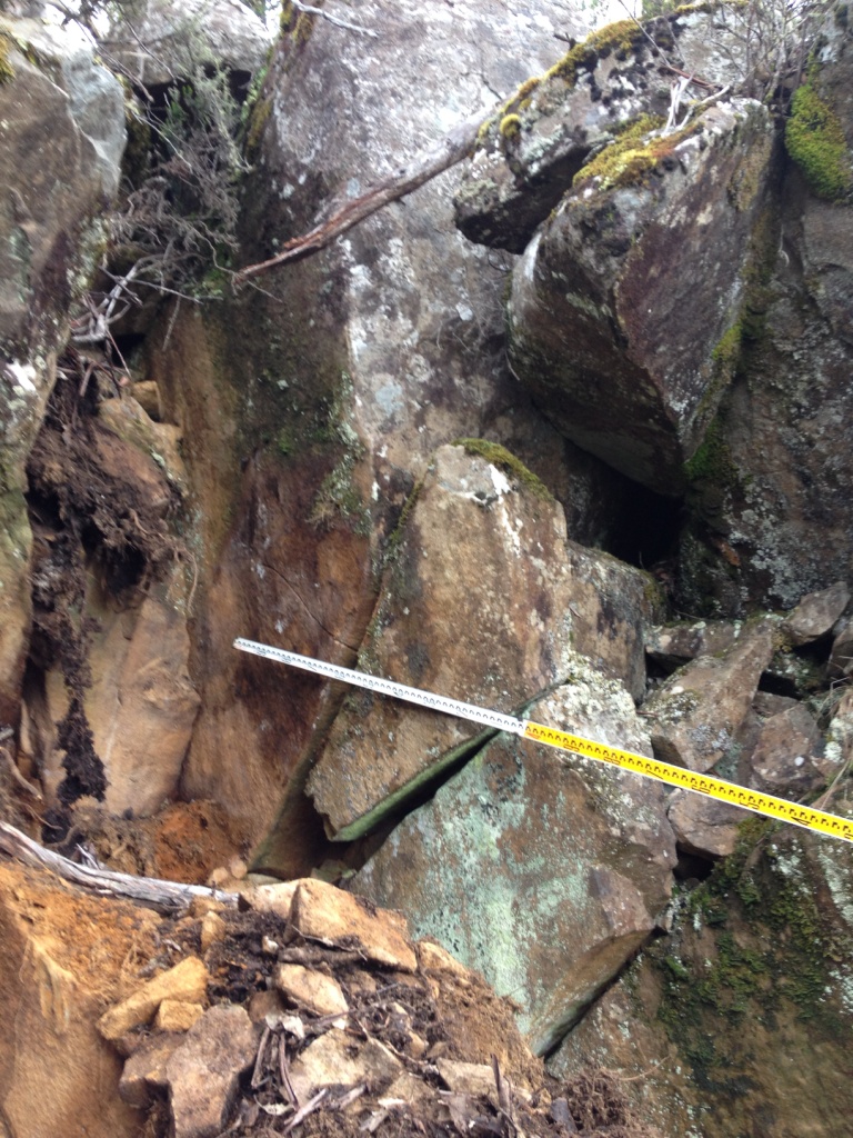
A scramble uphill by me and Matt Lindus (Council’s Acting Manager of Bushland & Reserves) found the source – an empty 2.5m wide space between two smaller but similarly leaning boulders. We temporarily closed Pinnacle Track while I reviewed slope stability issues, runout distances and hillside slopes. Overnight, I satisfied myself that the risk to track users was also “tolerable”, and recommended that the track be reopened. We’ll be looking to see what measures (if any) are needed to reduce the likelihood of the two remaining boulders toppling. Monitoring shows that the fallen boulder seems to have stabilised.

My risk assessments included reference to the Australian Geomechanics Society series of volumes on Landslide Risk Management (2007), and to the good work being done by Colin Mazengarb and Michael Stevenson at our local Mineral Resources Tasmania. They’ve produced a series of Landslide Hazard Maps for major population centres in Tasmania. (The Potential Rockfall Hazard Map for Hobart not surprisingly identifies the steep slopes of Mt Wellington as at risk of rockfalls, but it also shows that Pinnacle Track, and most others, are at risk of runout of boulders across them.) I also had valuable discussions with Victorian geotechnical engineer Tony Miner, my erudite sounding board for more than a handful of landslide issues.

I suspect that if a detailed assessment was done of walking tracks on the mountain, the risks to walkers would range from “acceptable” through “tolerable” to “unacceptable”. But closing high risk tracks would no doubt be a very unpopular move. Maybe we should redefine what we mean by acceptable and unacceptable risk for activities which are inherently riskier than others, but in which we willingly and knowingly engage.

The 50 tonne dolerite boulder. The staff is 3m high.
The 50 tonne dolerite boulder on 9 July 2014. The staff is 3m high.
The 50 tonne dolerite boulder, at rest against other smaller boulders, on 9 July 2014.
The 50 tonne dolerite boulder, at rest against other smaller boulders, on 9 July 2014. The string line was set up to monitor any forward toppling movement, but in fact the boulder settled backwards a few millimetres in the days after the fall.
The 2.5m wide gap left by the fallen boulder, between two other similarly leaning boulders, at 1,000m elevation.
The 170m travel path taken by the boulder, over 40+0 talus slopes and through 250 sub-alpine eucalypt forest slopes.

Filed Under: Geotechnical Investigations

Nice Tasmanian rockfall

November 16, 2013 by Bill Cromer Leave a Comment

Our shack at Spring Beach in eastern Tasmania is on a coastal cliff of Triassic-age sandstone. We’ve been holidaying there for 35 years, and though sand and silt and small pieces of stone fall every day from the cliff, I’ve never seen a bigger rock fall than this one. And I wasn’t there when it happened (!) – sometime between April and June 2013. Lucky no-one else was there either (if you were, and you’re still alive, let me know!).

The boulder is a cube of sandstone at least two metres on a side. With a density of about 2.5 tonnes per cubic metre, that’s about 20 tonnes in all. A few extra tonnes fell as a swag of smaller pieces.

The cliffs at Spring Beach recede slowly this way, and so do most cliffs, coastal or otherwise. Rockfalls (“geohazards”) are natural.

It was a nice fall – worthy of attention. The other reason I mention it is that it helps people like me try and work out how often falls like this happen. Then we can estimate risk to people. In itself, the single rock fall is not much help, but when added to other rock falls from the other end of Spring Beach, a picture starts to build up. At this other end, holidaymakers carved their names in the sandstone shore platform at the base of 30m sandstone cliffs back in the 1950s (where are they now?). Since our family noticed these back in the 1970s, when the names were half their age, they have been partly covered by boulders fallen from the cliff. (Smaller stuff gets quickly washed away by waves, but the 2 – 3 tonne boulders here are harder to shift.)

So, in 50 years or so, half a dozen boulders big enough to kill people have fallen from the Spring Beach cliffs — say, one a decade on average. The chances of a person being hit by one of these missiles is very low — we would have to say acceptably low — so I’m not about to suggest we close Spring Beach to the holidaying public just yet. Or ever.

Looking south to the sandstone cliffs at Spring Beach, Tasmania.
Sandstone overhang, southern cliffs, Spring Beach.
The recently fallen boulder. Southern end of Spring Beach.
The recently fallen boulder. Southern end, Spring Beach.

Source and pathway of the fallen boulder.
Looking down from the source to the fallen boulders. Southern end of Spring Beach.
Looking down from the source to the fallen boulders.
Another crop of fallen boulders. North end of Spring Beach, Tasmania.
Another crop of fallen boulders. North end, Spring Beach, Tasmania.

Looking to the source of the boulders, Northern Cliff, Spring Beach.
The way this boulder is lying over the date (1957) scratched into the rock by holiday makers suggests that this boulder fell some time after 1957.
This boulder fell some time after 1957.
Holiday-makers' names and dates scratched in stone beneath boulder. Northern Cliffs of Spring Beach, Tasmania.
Holiday-makers’ names and dates scratched in stone beneath boulder. Northern Cliffs, Spring Beach.


Filed Under: Geotechnical Investigations

New scar on kunanyi/Mt Wellington

August 25, 2015 by Bill Cromer Leave a Comment

The new scar on our majestic mountain is the white dribble down its flank, below the snowline and just right of centre, in the accompanying photo.

A little over a year ago, in July 2014, a 50 tonne boulder tipped over at the top of this dribble, and tumbled down the steep slope for about 170m. On the way it flattened hundreds of small alpine eucalypts, gouged soil, and halted just over the Pinnacle Track.  It’s path is hard to see most of the time, but in winter, snow preferentially accumulates and persists along the route, making this newest, natural scar plain to see. I’m surprised our avid mountain observers haven’t commented on it. Read more about the event in my news posted last year just after it happened.

A new scar on Mt Wellington (photo taken August 24, 2015)
A new scar on kunanyi/Mt Wellington. Photo taken August 24, 2015 from the Derwent Sailing Squadron on the Derwent River.

Can I call it “Bill’s Dribble”?

There are plenty of other, older scars on the mountain, relics of past slope movement. I think our new mountain dribble will slowly disappear over the next several decades. There are no other similar ones visible, suggesting that falling rocks of this size don’t happen very often.

Filed Under: General

Subscribe to my newsletter
Profile of Bill Cromer

Geologist, thylacine author, tennis player [more about me].

Contact Bill

  • Email
  • Google+
  • Twitter

PH 0408 122 127

INT +61 408 122 127

Recent Posts

  • Codes in the 2015 Tasmanian Interim Planning Scheme
  • Flowchart for applying the Tasmanian Acid Sulphate Soils Code
  • Flowchart for applying the Tasmanian Coastal Erosion Hazard Code
  • Tasmanian Landslide Code
  • Tasmanian On-site Wastewater Management Code

News Archive

View full archive

News Archive by Month

  • August 2016 (3)
  • May 2016 (2)
  • August 2015 (1)
  • June 2015 (2)
  • March 2015 (7)
  • February 2015 (1)
  • July 2014 (2)
  • June 2014 (1)
  • March 2014 (1)
  • December 2013 (2)
  • November 2013 (1)
  • October 2013 (6)
  • July 2013 (3)
  • May 2013 (2)

Professional Services

  • Geotechnical Investigations
  • Soil Testing
  • Groundwater
  • Wastewater
  • Coasts

Products

  • Cromer Hydrogeological Calculators
  • Cromer Constant Head Field Permeameter
  • Trench® Wastewater Software

News Categories

  • Apps & Software
  • Cromer Permeameter
  • General
  • Geology
  • Geotechnical Investigations
  • Groundwater
  • Landslides
  • Thylacine
  • Vulnerable Coasts and Sea Levels
  • Wastewater
  • Home
  • Professional Services
  • Products
  • About
  • News
  • Publications
  • Contact me

Contact

  • Email
  • Google+
  • Twitter

PH 0408 122 127

INT +61 408 122 127

Copyright ©2023 Bill Cromer. All Rights Reserved.